Achieve Highly Detailed 3D Colorized Digital Models with Lidar Scanning
By John Smits, V.P. AEC 3D Scanning Division of ECM
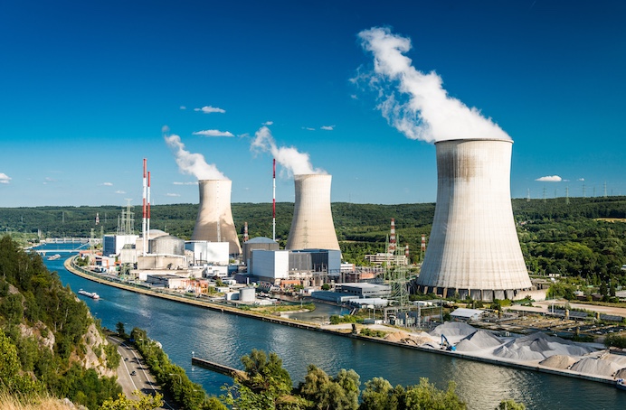
Retrofitting and renovations are projects that often require a high level of detail for pre-design documentation. When it comes to power plants, add to the mix multiple heights of pipes, ducts, exposed steel structure and a limited access window for onsite measurements and your documentation phase has now become a challenging logistical exercise. How do you quickly develop a 3D digital twin of existing conditions so you can properly plan for new piping and structure?
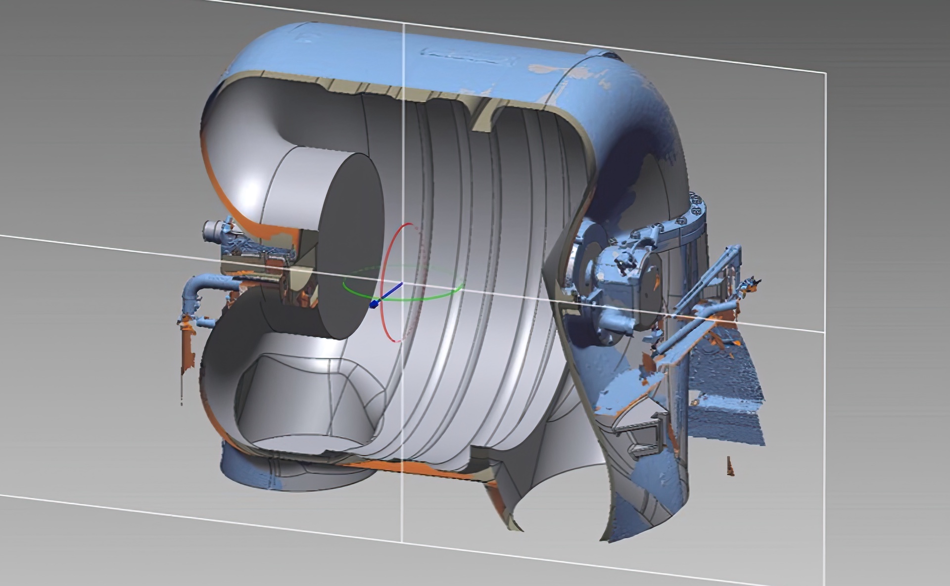
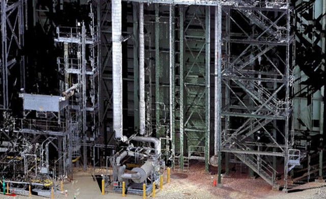
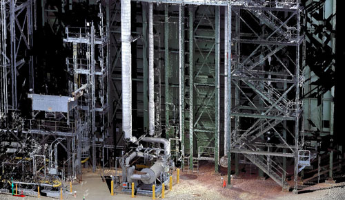
ECM – Global Measurement Solutions, leading provider of 3D Lidar Scanning and Design Engineering Services, was presented with such a task when asked to provide a 3D model of a power plant slated for renovations. Faced with retrofitting of the recovery exhaust containment areas, the client required an accurate 3D digital file indicating all surrounding pipes, structure, and fittings, down to the access hatches and bolt locations. The 3D scan data was to be taken in color, so the resulting digital file enabled ease of pipe and duct identification.
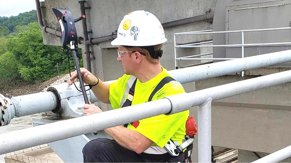
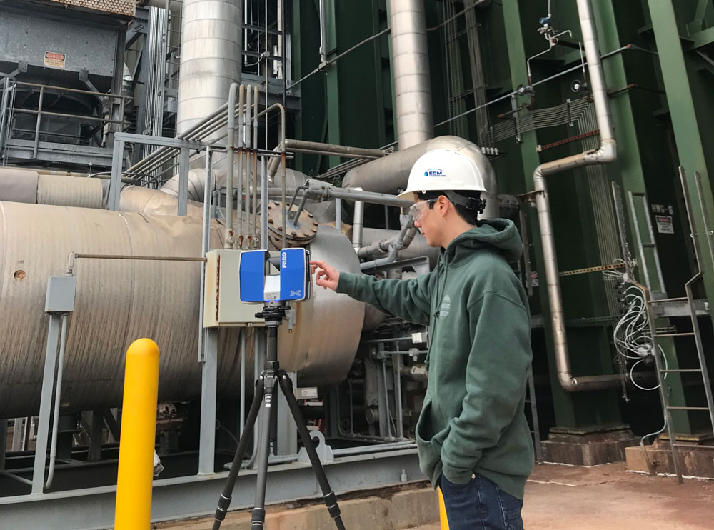
A two-man team was sent to the site with a FARO Focus X330 laser scanner to document the needed areas. The scanner’s long range and variable resolution capabilities enabled quick capture of point cloud data while obtaining enough density of points for delineation of the various pipes and fittings. This would translate into a level of detail sufficient to allow for Revit modeling of the smallest elements. The documentation process involved multiple scanning locations. To capture all needed information, scans were required at various heights and locations, moving the scanner in and out of the power plant’s articulated facade as well as up ladders, walkways, and below raised equipment. Some scans were placed as little as six feet apart, to enable line of sight access to important elements hidden between existing pipes, scaffold and walkways.
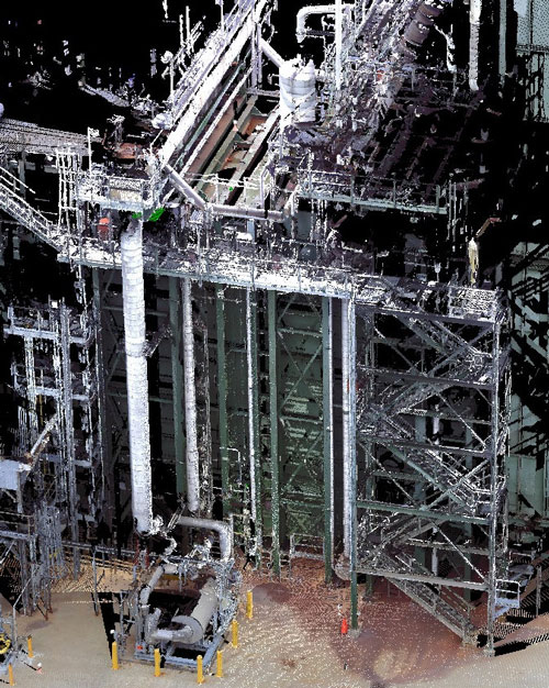
The key to successfully capturing a 3D image of the plant facility area to be documented was to align and tie the two opposite sides of the plant together within the digital model. The common link between the sides, other than the roof above, was an open passageway below set between two large steel beams about twenty inches above grade. By lowering the scanner to sit just above grade, ECM’s skilled technicians could access this passageway on a crawl and obtain accurate 3D scan views. These would not only tie the two halves together but provide needed information to the client on the passageway’s size and configuration for their use in designing new piping in that area.
Spherical targets were setup around the perimeter of all areas to be scanned as well as in the passageway below the recovery chiller unit. This allowed all scans to be accurately aligned into a comprehensive 3D model when
processed back at ECM’s headquarters just outside of Boston, Massachusetts. The precision of scan data is a fixed attribute based upon the scanner’s calibration and technical specifications. The overall accuracy of a scanning project is due to the skill and methodology used in capturing and aligning the various scans. ECM has found the use of targets to be invaluable in establishing good field controls leading to an accurate 3D model. This in turn creates a dependable 3D deliverable upon which the customer can make informed design decisions.
Time of completion was an important factor for this project. On site scanning had to be completed in one day, when the facility was in “down mode,” and the resulting processed and aligned 3D file had to be delivered within a few days following the scanning. ECM’s experience and expertise with established workflows from past projects of similar scope enabled them to meet the client’s schedule and deliver the colorized 3D digital model on time and within budget. This provided the client a reliable basis on which to design the retrofitting and sequence of construction, utilizing the capabilities of 3D lidar scanning documentation to save time and money.