How the Focus3D 330 Works
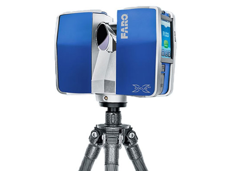
The technology behind the Focus3D X 330 is simple. First, the laser scanner emits a laser beam from a rotating mirror out towards the area being scanned. Then the unit distributes the laser beam at a vertical range of 300° and a horizontal range of 360°. The laser beam is then reflected back to the scanner by objects in its path. The distance to the objects defining an area is calculated as well as their relative vertical and horizontal angles. The data is captured and transmitted via WLAN for calculating precise 3D renderings.
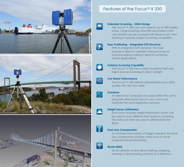
Features
- Extended Scanning – 330m Range
- Easy Positioning – Integrated GPS Receiver
- Outdoor Scanning Capability
- Low Noise Performance
- Compass
- Height Sensor (Altimeter)
- Dual Axis Compensator
- WLAN (WiFi)
Benefits to the End User
- 330m scanning range reduces the number of scans per project
- Portability allows user to scan complex objects and environments
- GPS receiver helps correlate individual scans during post-processing
- Touch-screen interface makes the scanner easy for anyone to use
- Provides long term investment for future projects
- Real world environments are preserved in a virtual 3D world
- Unsurpassed cost-value proposition make every scanning project economical

Performance Specifications
Ranging Unit
Unambiguity Interval: By 122 till 488 Kpts/sec at 614m; by 976 Kpts/sec at 307m
Range Focus3D X 330: 0.6m – 330m indoor or outdoor with upright incidence to a 90% reflective surface
Measurement Speed (pts/sec): 122,000 / 244,000 / 488,000 / 976,000
Ranging Error: ±2mm
Color Unit
Resolution: Up to 70 megapixel color
Dynamic Color Feature: Automatic adaption of brightness
Parallax: Co-axial design
Deflection Unit
Vertical Field of View (vertical/horizontal): 300° / 360°
Step Size (vertical/horizontal): 0.009° (40,960 3D-Pixel on 360°) / 0.009° (40,960 3D-Pixel on 360°)
Max. Vertical Scan Speed: 5,820rpm or 97Hz
Data Handling and Control
Data Storage: SD, SDHC™, SDXC™; 32GB card included
Scanner Control: Via touch-screen display and WLAN
New WLAN Access: Remote control, scan visualization are possible on mobile devices with Flash®
Laser (Optical Transmitter)
Laser Class: Laser class 1
Wavelength: 1550nm
Beam Divergence: Typical 0.19mrad (0.011°) (1/e, halfangle)
Beam Diameter at Exit: Typical 2.25mm (1/e)
Multi-Sensor
Dual Axis Compensator: Levels each scan with an accuracy of 0.015° and a range of ±5°
Height Sensor: Via an electronic barometer the height relative to a fixed point can be detected and added to a scan
Compass: Electronic compass gives the scan an orientation. A calibration feature is included.
GPS: Integrated GPS receiver
Hardware Specifications
Power Supply Voltage: 19V (external supply), 14.4V (internal battery)
Power Consumption: 40W and 80W (while battery charges)
Battery Life: 4.5 hours
Ambient Temperature: 5° – 40°C
Humidity: Non-condensing
Cable Connector: Located in scanner mount
Weight: 5.2kg
Size: 240 x 200 x 100mm
Maintenance Calibration: Annual


