
FARO Laser Scanner Focus3D X 330
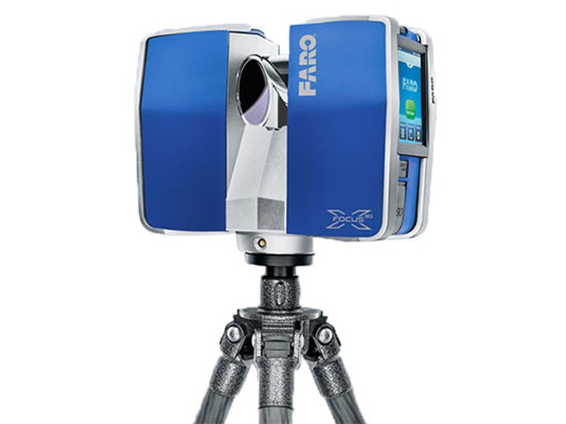
FARO Laser Scanner Focus3D X 330
Building on the success of the Focus3D, the Focus3D X 330 surpasses previous models in functionality and performance. Designed for 3D documentation and land surveying with a range almost three times greater than previous models, the Focus3D X 330 can scan objects up to 330 meters away and in direct sunlight. With its integrated GPS receiver, the laser scanner is able to correlate individual scans in postprocessing making it ideal for surveying based applications. In addition, the Focus3D X 330 scan quality has been increased and noise has been reduced, providing precise three dimensional models in a photo-realistic style. These advances in performance did not come at the expense of safety as the Focus3D X 330 includes a Class 1 “eye safe” laser. With its increased range and scan quality, the Focus3D X 330 considerably reduces the effort involved in measuring and postprocessing. The 3D scan data can easily be imported into all commonly used software solutions for accident reconstruction, architecture, civil engineering, construction, forensics, industrial manufacturing and land surveying. Distance dimensions, area and volume calculations, analysis and inspection tasks and documentation can thus be carried out quickly, precisely and reliably.
Overview
How the Focus3D 330 Works
The technology behind the Focus3D X 330 is simple. First, the laser scanner emits a laser beam from a rotating mirror out towards the area being scanned. Then the unit
distributes the laser beam at a vertical range of 300° and a horizontal range of 360°. The laser beam is then reflected back to the scanner by objects in its path. The distance to the objects defining an area is calculated as well as their relative vertical and horizontal angles. The data is captured and transmitted via WLAN for calculating
precise 3D renderings.
Features
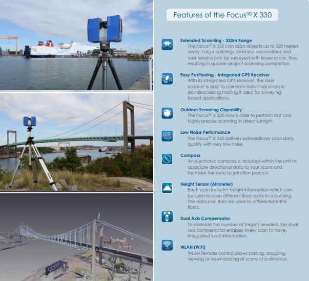
- Extended Scanning - 330m Range
- Easy Positioning - Integrated GPS Receiver
- Outdoor Scanning Capability
- Low Noise Performance
- Compass
- Height Sensor (Altimeter)
- Dual Axis Compensator
- WLAN (WiFi)
Benefits to the End User
- 330m scanning range reduces the number of scans per project
- Portability allows user to scan complex objects and environments
- GPS receiver helps correlate individual scans during post-processing
- Touch-screen interface makes the scanner easy for anyone to use
- Provides long term investment for future projects
- Real world environments are preserved in a virtual 3D world
- Unsurpassed cost-value proposition make every scanning project economical
Performance Specifications
Ranging Unit
|
Color Unit
|
Deflection Unit
|
Data Handling and Control
|
Laser (Optical Transmitter)
Multi-Sensor
|
Hardware Specifications
|
Register to Rent / Purchase
Fill out the form below and an ECM representative will contact you shortly to discuss your next steps.
By submitting you are expressing agreement to our Terms of Service and Privacy Policy.